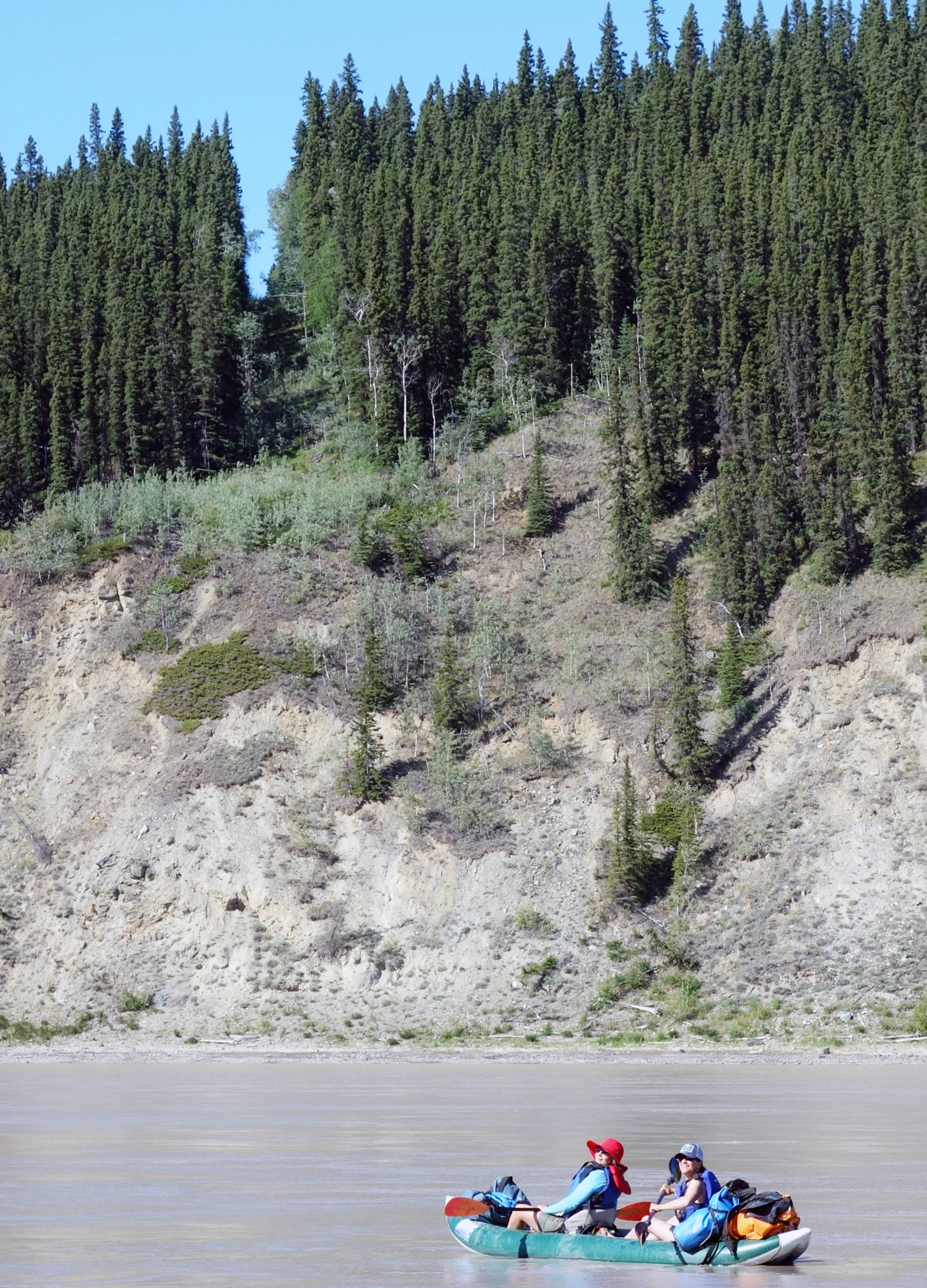
Two boaters on the Yukon River cross from the Yukon into Alaska on July 5. The border is marked by a 20-foot clearing and a metal obelisk. (Courtesy Photo | Ned Rozell)

Two boaters on the Yukon River cross from the Yukon into Alaska on July 5. The border is marked by a 20-foot clearing and a metal obelisk. (Courtesy Photo | Ned Rozell)

The thin line between Alaska and Canada

Alaska’s border with Canada is one of the great feats of wilderness surveying.

Marked by metal cones and a clear-cut swath 20 feet wide, Alaska’s border with Canada is one of the great feats of wilderness surveying.

The boundary between Alaska and Canada is 1,538 miles long. The line is obvious in some places, such as the Yukon River valley, where crews have cut a straight line through forest on the 141st Meridian. The boundary is invisible in other areas, such as the summit of 18,008-foot Mt. St. Elias.

In the early 1900s, workers cemented boundary monuments made of aluminum-bronze and standing 2.5-feet tall along much of the border’s length.

The country that makes up the border is some of the wildest in North America. Spanning a gap equal to the distance between San Francisco and St. Louis, the line of the border touches just one town: Hyder in Southeast Alaska.

Starting in 1905, surveyors and other workers of the International Boundary Commission trekked into this wilderness to etch into the landscape a brand-new political boundary.

The border was unknown in 1867, when the U.S. purchased Alaska from Russia for two cents an acre. An 1825 treaty between Russia and Great Britain, then the controlling power of Canada, described the boundary as following a range of mountains in Southeast parallel to the Pacific Coast, but in some places no such mountains existed.

The undefined border in Southeast became a problem during the Klondike gold rush of the late 1890s, when Canadian officials requested ownership of Skagway and Dyea, which would allow Canadians access to the Klondike gold fields without crossing American soil.

To settle the dispute in 1903, President Theodore Roosevelt gathered a committee of three Americans, two Canadians, and England’s chief justice. The British representative, Lord Richard Alverstone, sided with the three Americans, and the committee rejected the Canadian claims by a vote of four to two.

With a boundary agreed upon, the next step was the immense job of surveying and marking it. In 1904, crews of men from both the U.S. and Canada started work on the panhandle of southeast Alaska. They used boats, packhorses and backpacks to reach the remote mountains of Southeast.

In a typical effort, a Canadian crew led by H.S. Mussell in 1911 searched for a boundary point near Mount St. Elias. The crew landed a ship in the rough surf of Disenchantment Bay and transferred hundreds of pounds of gear to the foot of a glacier. Assisted by 10 Natives, the crew cut a trail across tangled brush, and set up an aerial tramway across a glacial stream that the Natives thought too dangerous. Without local escorts, the crew made its way up Malaspina Glacier using sleds and identified the boundary point on an unnamed peak.

By 1913, crews farther north had marked the straight line of the 141st Meridian from the Arctic Ocean to the south side of Logan Glacier. They left behind 202 obelisks — shaped like tiny Washington Monuments — that now line the border.

A man working with the International Boundary Commission in the early 1900s poses next to one of more than 200 obelisks that line the Alaska/Canada border. (Courtesy photo | NOAA Photo Library)

A man working with the International Boundary Commission in the early 1900s poses next to one of more than 200 obelisks that line the Alaska/Canada border. (Courtesy photo | NOAA Photo Library)

Thomas Riggs was a crew chief for the International Boundary Commission. He spent eight summers, which he called the happiest of his life, marking the border. After his crew tied in the final section of border east of McCarthy in 1914, he described his feelings for the raw wilderness work with a short telegram to his supervisor at the end of August 1914:

“REGRET MY WORK COMPLETED.”


• Since the late 1970s, the University of Alaska Fairbanks’ Geophysical Institute has provided this column free in cooperation with the UAF research community. Ned Rozell ned.rozell@alaska.edu is a science writer for the Geophysical Institute. A version of this column ran in 2001.

More in News

(Juneau Empire file photo)
Aurora forecast through the week of Feb. 1

These forecasts are courtesy of the University of Alaska Fairbanks’ Geophysical Institute… Continue reading

Two flags with pro-life themes, including the lower one added this week to one that’s been up for more than a year, fly along with the U.S. and Alaska state flags at the Governor’s House on Tuesday. (Mark Sabbatini / Juneau Empire)
Doublespeak: Dunleavy adds second flag proclaiming pro-life allegiance at Governor’s House

First flag that’s been up for more than a year joined by second, more declarative banner.

Students play trumpets at the first annual Jazz Fest in 2024. (Photo courtesy of Sandy Fortier)
Join the second annual Juneau Jazz Fest to beat the winter blues

Four-day music festival brings education of students and Southeast community together.

Frank Richards, president of the Alaska Gasline Development Corp., speaks at a Jan. 6, 2025, news conference held in Anchorage by Gov. Mike Dunleavy. Dunleavy and Randy Ruaro, executive director of the Alaska Industrial Development and Export Authority, are standing behind RIchards. (Yereth Rosen/Alaska Beacon)
For fourth consecutive year, gas pipeline boss is Alaska’s top-paid public executive

Sen. Bert Stedman, R-Sitka, had the highest compensation among state legislators after all got pay hike.

Juneau Assembly Member Maureen Hall (left) and Mayor Beth Weldon (center) talk to residents during a break in an Assembly meeting Monday, Feb. 3, 2025, about the establishment of a Local Improvement District that would require homeowners in the area to pay nearly $6,300 each for barriers to protect against glacial outburst floods. (Mark Sabbatini / Juneau Empire)
Flood district plan charging property owners nearly $6,300 each gets unanimous OK from Assembly

117 objections filed for 466 properties in Mendenhall Valley deemed vulnerable to glacial floods.

(Michael Penn / Juneau Empire file photo)
Police calls for Sunday, Feb. 2, 2025

This report contains public information from law enforcement and public safety agencies.

(Michael Penn / Juneau Empire file photo)
Police calls for Saturday, Feb. 1, 2025

This report contains public information from law enforcement and public safety agencies.

(Michael Penn / Juneau Empire file photo)
Police calls for Friday, Jan. 31, 2025

This report contains public information from law enforcement and public safety agencies.

University of Alaska President Pat Pitney gives the State of the University address in Juneau on Jan. 30, 2025. She highlighted the wide variety of educational and vocational programs as creating opportunities for students, and for industries to invest in workforce development and the future of Alaska’s economy. (Corinne Smith/Alaska Beacon)
University of Alaska president highlights impact on workforce, research and economy in address

Pat Pitney also warns “headwinds” are coming with federal executive orders and potential budget cuts.

Most Read